The Environment Agency has said that Pateley Bridhe and Knaresborough are at risk of flooding today.
Environment Agency Alert see https://flood-warning-information.service.gov.uk/target-area/122WAF941
Environment Agency Alert of Upper River Nidd
Flooding is possible – be prepared
This flood alert is being issued as a result of forecast rainfall associated with Storm Dennis. We expect river levels to start to rise throughout the upper catchment this afternoon on Saturday 15.2.20.
We expect to issue flood warnings for Pateley Bridge and Knaresborough later today.
For up to date river levels, please see the gov.uk website. We are closely monitoring the situation and our Area Incident Room is open.
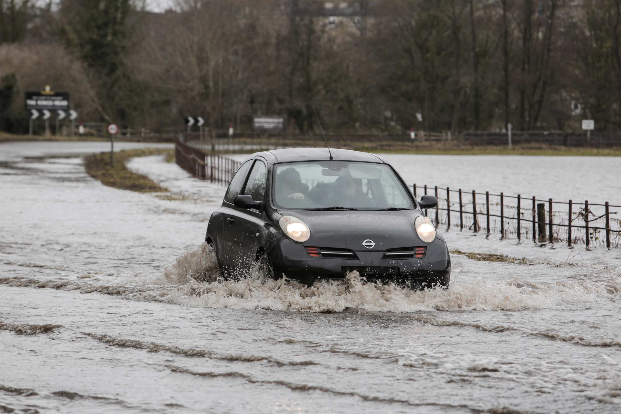
Please avoid using low lying footpaths near local watercourses and plan driving routes to avoid low lying roads near rivers, which may be flooded. This message will be updated in 8 hours or as the situation changes.
This information was last updated at 1:14pm Saturday 15 February 2020
Live River Levels for Pateley Bridge and Knaresborough
A team of multi-agency experts, led by the County Council, is working with district councils and City of York, the emergency services, the Met Office and the Environment Agency to track where the strong winds and heavy rain are most likely to hit.
Response units from a number of agencies are on the ground ready to do everything they can to keep people safe and to support communities before, during and after the second storm in a week. The number of available sandbags is being increased and highways teams are on patrol.
There is no absolute certainty about where the worst impact will be. However, continuous rain interspersed with pulses of heavy downpours, combined with snow melt on higher ground and strong, gusty winds across the county could deliver potentially challenging conditions.
People are therefore reminded to take sensible steps to be prepared to protect homes and businesses where necessary and are asked not to travel unless unavoidable. Standing water on roads and potential flood water could make driving conditions treacherous. Above all people are asked not to drive through flood water, not to go through road closed signs and to keep away from rivers and open water as this could endanger lives.
County Council Chief Executive Richard Flinton is the Chair of the multi-agency North Yorkshire Local Resilience Forum, which includes the City of York. He said:
We are standing up resources to deal with what could be a potentially serious situation but we are sure the public would understand that we are targeting those resources at the areas which are the highest priority.
Combined with melting snow on some high ground and the fact that a lot of land is already saturated following Storm Ciara last weekend, we are focused on targeting resources where the impacts of further rain are most likely.
We advise people to watch the weather forecast from the Met Office, to consider whether there is action they need to take and to keep a close eye on travel conditions.
Above all we would urge people to postpone travel plans if at all possible, to keep safe and not to drive through flood water and road closure signs and keep away from open water in any event as this can endanger lives.
In the run-up to the storm county council highways staff have been on the ground across the county checking bridges and gully cleaning after Storm Ciara last week in order to be as ready as we can be for Storm Dennis today.
Nigel Smith, Head of Highway Operations, said:
We are experienced and have a strong track record in responding effectively to events of this nature. Our teams are on the ground today and will do everything they can to keep people safe and to support communities during and after this weather event.
I would ask that drivers play their part by heeding any flood warnings or road closures we need to put into place. We do so for everyone’s safety, but last weekend there were instances of people removing signs and driving into flood water. Even if the flood water has receded, bridges and other structures may need to be inspected to ensure they are safe for use. Not only is removing signs dangerous, it is an offence.
Updates on road closures will be posted on the council’s website, https://www.northyorks.gov.uk/flooding-advice-and-information
Superintendent Jason Dickson of North Yorkshire Police, said:
We will continue to work closely with other organisations to keep routes as clear as possible should we see a repeat of difficult conditions caused by Storm Ciara. Our advice is to be prepared and do not make unnecessary journeys.
If you see a diversion, remember it’s there for your safety. If a road is flooded or closed, please don’t be tempted to chance it – it won’t save you any time and it could be a costly mistake.
The multi-agency response from the York and North Yorkshire Local Resilience Forum involves North Yorkshire County Council, North Yorkshire Fire and Rescue Service, North Yorkshire Police, City of York Council, Richmondshire District Council, Hambleton District Council, Rydale District Council, Scarborough Borough Council, Selby District Council, Craven District Council, Harrogate Borough Council, Northern Power Grid, The Environment Agency and the Met Office and Mountain Rescue teams. Working as NYLRF, the partners routinely work together to plan for emergencies and mitigate their impact.
You can find the latest highways information, MET office weather forecasts and Environment Agency warnings here: https://www.northyorks.gov.uk/flooding-advice-and-information