North Yorkshire Council is enacting plans to lower speed limits from 30mph to 20mph in the south and west of Harrogate.
This decision follows a petition presented to the council in June 2023 and a public consultation held in December last year.
A three-year research project by Queen’s University Belfast found that 20mph speed limits made little difference to safety, but did reduce the volumes of traffic.
- Data was collected over 76 streets in the centre of Belfast prior to the introduction of the 20mph rollout
- Data was compared over 1 and 3-years with data collected from nearby streets where the 20mph were not in place and similar roads elsewhere in Northern Ireland that had retained their speed limits (30-40 mph).
- The new 20mph limits led to minimal change in short or long-term outcomes for road traffic collisions, casualties, or speeding.
- Road traffic collisions fell by 3% over one-year and 15%, three-year
- Casualty rates fell by 16% over one-year and 22%, respectively. However, researchers said these reductions were not statistically significant.
- The data also showed that the average traffic speed fell by only 0.2mph after the first year. This increased slightly after year three to 0.8mph.
In Harrogate, the first phase of the project will see speeds reduced to 20mph on 190 roads in total.
Traffic calming measures could be introduced to lower speeds on additional roads in the area under a second phase of the project, which is subject to further consultation.
North Yorkshire Council’s executive member for highways and transportation, Cllr Keane Duncan, said:
This is by far the largest 20mph scheme ever introduced by the council.
It’s part of our dedicated and continuing effort to improve road safety, here in Harrogate and across North Yorkshire.
While this project is significant in scale, and a landmark achievement for everyone involved, we have ensured that 20mph is appropriate for the nature of these roads.
As well as speed surveys, we have also conducted extensive local consultation to ensure there is public support for our plan.
We continue to be clear that taking a blanket approach to 20mph limits is wrong given the vast and diverse nature of North Yorkshire.
We will always recognise the unique nature of different locations and continue to work with our communities to deliver positive improvements.
The new 20mph limits are expected to be introduced over the next few months.
The council is assessing more than 400 education sites across the county, including schools, nurseries, and colleges, starting with those where speed limits are the highest.
The authority has adopted a presumption in favour of lowering speed limits in these locations.
So far, lower speed limits have been introduced or recommended for introduction at 22 education sites including nurseries and colleges. A further 16 schemes are in the process of being consulted on, with lower speed limits expected to be introduced there.
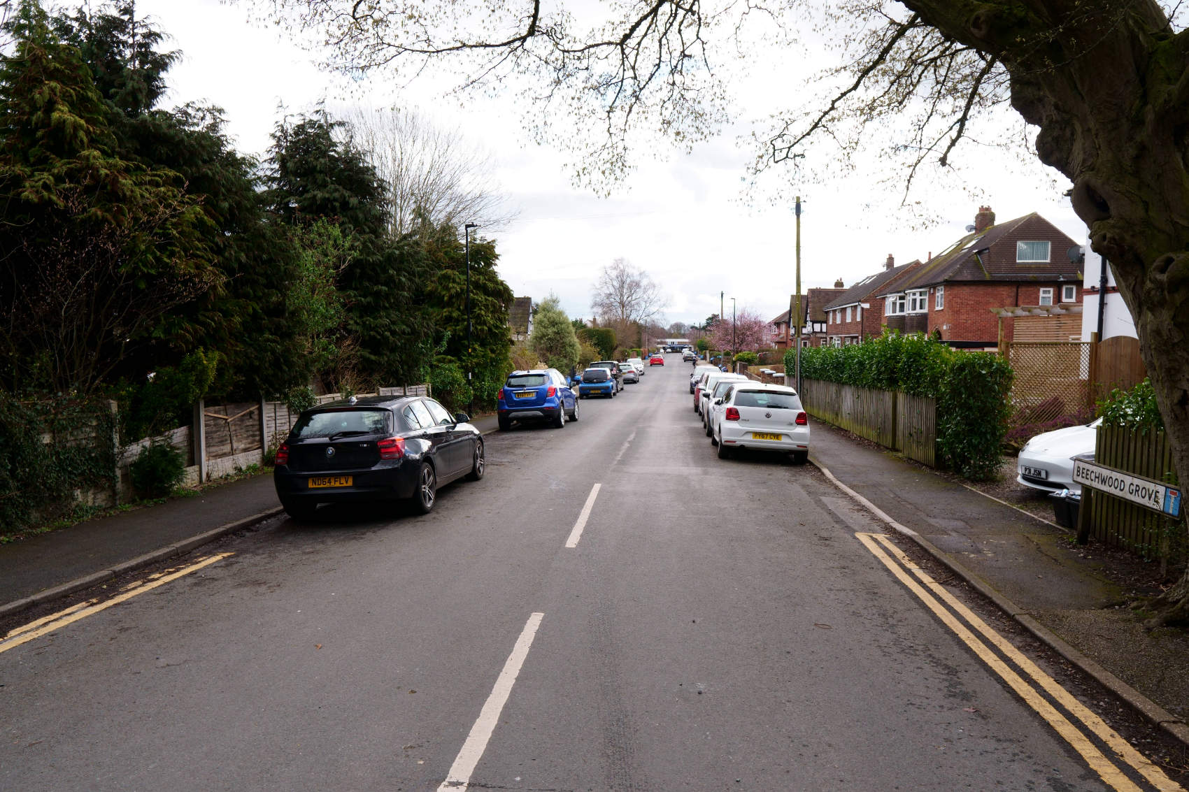
The roads in Harrogate that will have 20mph limits
Alderson Road, Alderson Square, Almsford Avenue, Almsford Close, Almsford Drive, Almsford
Place, Almsford Oval, Almsford Road, Almsford Walk, Apley Close, Arncliffe Road, Arthurs
Avenue, Ash Road, Back Tewit Well Road, Beech Avenue, Beech Road, Beckwith Avenue,
Beechwood Grove, Belgrave Crescent, Birchwood Mews, Bleinham Way, Bowes Park, By-ways
(U116), Calder Road, Carlton Road, Cavendish Avenue, Cedar Grange, Coachmans Court,
College Road & College Street rear, College Street, Coronation Avenue, Coronation Grove,
Coronation Road, Cromwell Road, Daleside Avenue, Daleside Close, Daleside Drive, Daleside
Gardens, Daleside Road, Firs Avenue, Firs Close, Firs Crescent, Firs Drive, Firs Gate, Firs Grove,
Firs Road, Firs View, Fulwith Avenue, Fulwith Close, Fulwith Drive, Fulwith Gate, Fulwith Grove,
Fulwith Mill Lane, Fulwith Road, Gladstone Street to Hookstone Road, Grey Street, Halstead
Avenue, Harlow Avenue, Harlow Crescent, Harlow Park Crescent, Harlow Park Drive, Harlow Park
Road, Hartley Road, Hookstone Avenue, Hookstone Oval, Hookstone Wood Road, Hornbeam
Crescent, Hutton Gate, Innisfree Close, Kenilworth Avenue, Langcliffe Avenue, Langcliffe Avenue
East, Leadhall Avenue, Leadhall Crescent, Leadhall Drive, Leadhall Gardens, Leadhall Grove,
Mallinson Crescent, Mallinson Gate, Mallinson Grove, Mallinson Oval, Mallinson Way, Merryfield,
Mount Gardens, Mount Street, Newland Avenue, Norfolk Road, Otley Road rear from Wharfedale
Avenue, Pannal Ash Crescent, Pannal Ash Drive, Pannal Ash Grove, Pannal Ash Road, Park
Avenue, Park Avenue South, Park Drive, Park Road, Phillipa’s Drive, Rayleigh Road, Rear St
George’s Road (U3021), Rear St George’s Road (U3022), Redfearn Mews, Rhodes Drive,
Richmond Avenue, Richmond Close, Richmond Holt, Richmond Road, Road rear of Coronation
Avenue (U1153), Road rear of Coronation Avenue (U1154), Road rear of Cromwell Road (U1157),
Road rear of 1 to 33 Gladstone Street (U1179), Road rear of 10 to 60 Gladstone Street (U1177),
Road rear of Grey Street (U1186), Road rear of Hookstone Avenue (U1209), Road rear of
Hookstone Road (U1210), Road rear of Leeds Road, Road rear of Mount Street, Road rear of 1 to
29 Russell Street (U1255), Road rear of 2 to 30 Russell Street (U1256), Road rear of West End
Avenue (U1277), Road rear of West End Avenue (U1278), Road rear of West End Avenue
(U1279), Road rear of West End Avenue (U1280), Road rear of West End Avenue (U1281), Road
rear of West Lea Avenue, Robinson Drive, Rossett Beck, Rossett Crescent, Rossett Drive (U648),
Rossett Drive, Rossett Garth, Rossett Park Road, Rowanlea, Russell Street, Shippen End, South
Drive (U687), South Drive (U720), Stone Rings Close, Stone Rings Grange, Stone Rings Lane,
Stray Rein, Stray Road, Stray Walk, St Athan’s Walk, St Catherine’s Road, St Clement’s Road, St
Clement’s Road South, St George’s Avenue, St George’s Road, St George’s Walk, St Helen’s
Road, St Hilda’s Road, St James’ Drive, St Leonard’s Close, St Leonard’s Oval, St Leonard’s
Road, St Mark’s Avenue (U732, St Mark’s Avenue (U3221), St Ronan’s Road, St Winifred’s
Avenue, St Winifred’s Avenue West, St Winifred’s Road, Tewit Well Avenue, Tewit Well Road, The
Oval (U574), The Oval (U783), Trinity Road, Verity Walk, Vernon Road, Warwick Crescent,
Waverley Crescent, Wayside Avenue, Wayside Close, Wayside Crescent, Wayside Grove,
Wayside Walk, Wensley Grove, Westbourne Avenue, Westdene, West End Avenue (U836), (West
End Avenue (3202), West Lea, Westway, Wharfedale Avenue, Wharfedale Avenue rear,
Wharfedale Place, Wheatlands Grove, Wheatlands Grove, Wheatlands Road, Wheatlands Road
East, Wheatlands Way, Windsor Road, Woodlands Green, Wood Park Close, Woods Court and
Yewdale Road.